Overview
Auden’s Col Trek
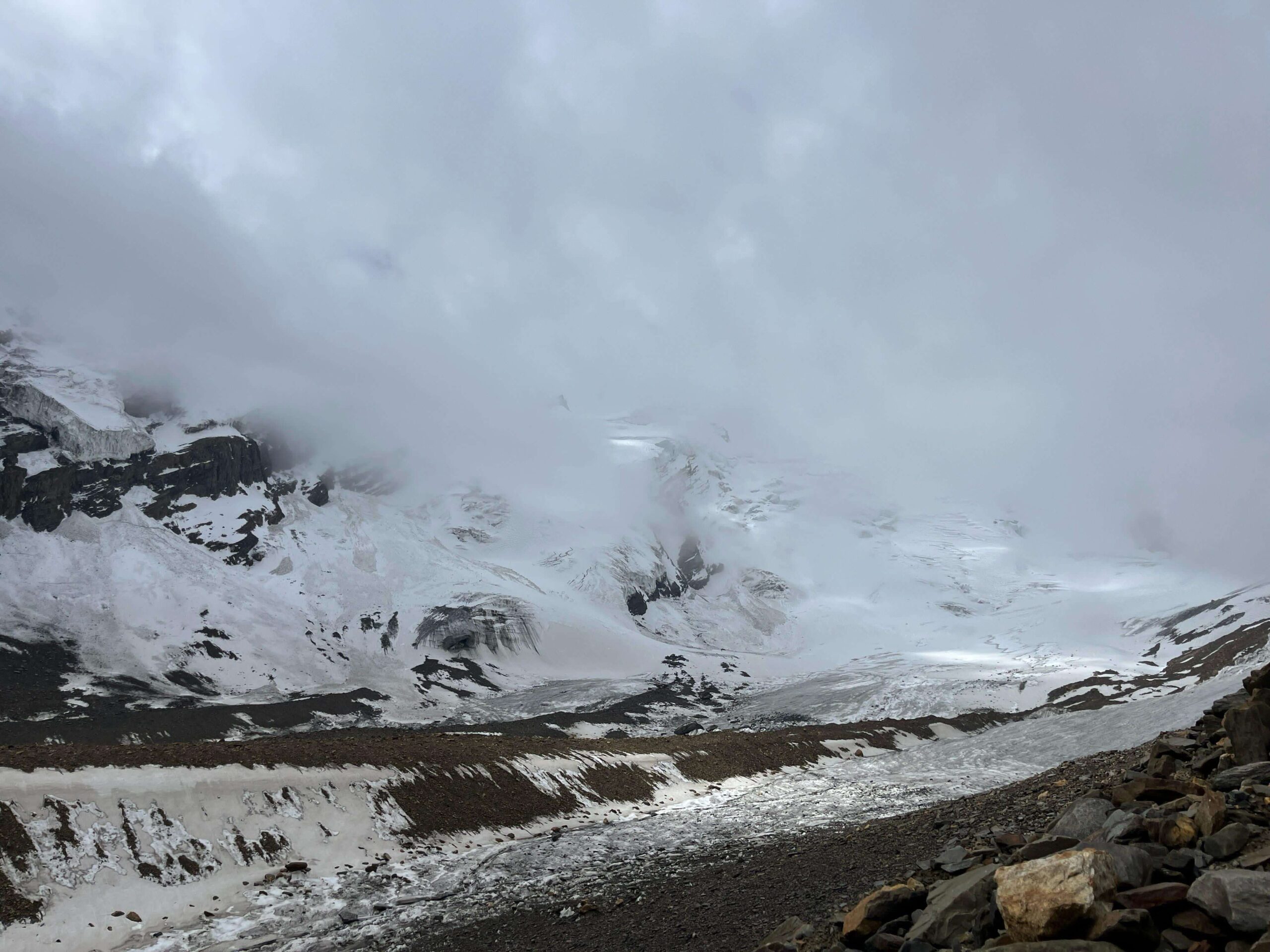
The Auden’s Col Trek is one of the toughest treks in India as there are many steep climbs and involves long hours of walking. It is located in the Uttarkashi district of Uttarakhand and connects the Gangotri Valley to the Kedarnath Valley. The Auden’s Col Trek begins at Gangotri and ends at Gaurikund. The entire trek is around 85-100 km and takes 16 days to complete. It is an extremely difficult trek and requires technical mountaineering skills. The Discovery Hike Team will make sure that you complete the trek in the safest way possible. June and September are the best time to visit Auden’s Col Trek as the temperatures are comparatively favourable and the weather is good. The trek got its name from the British poet W.H. Auden. He was a travel enthusiast and explored this route for the first time in 1936.
What makes Auden’s Col Trek special?
The Auden’s Col Trek is famous mainly because it acts as the connecting route between two major pilgrimages in India – Kedarnath and Gangotri. The route is closed for almost half the year which makes it even more special. The challenging terrain makes it an exciting option for adventure seekers, who look to break their limits.
Not many people visit the Auden’s Col Trek, making it a great opportunity for solitude lovers. After the first few days the serenity and quietness of the place might overwhelm you. It is a good place to meditate and stay away from the busy life for a while.
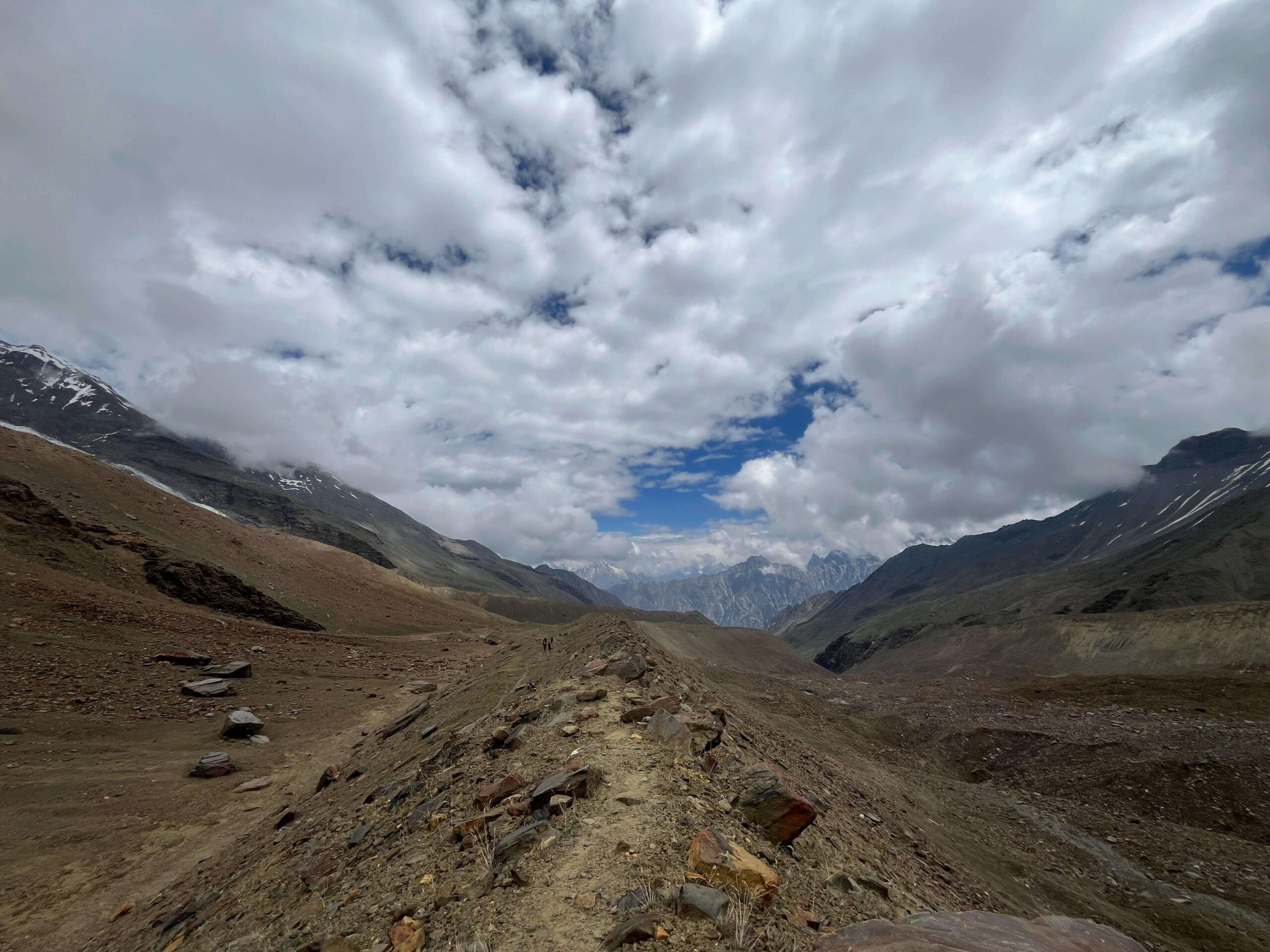
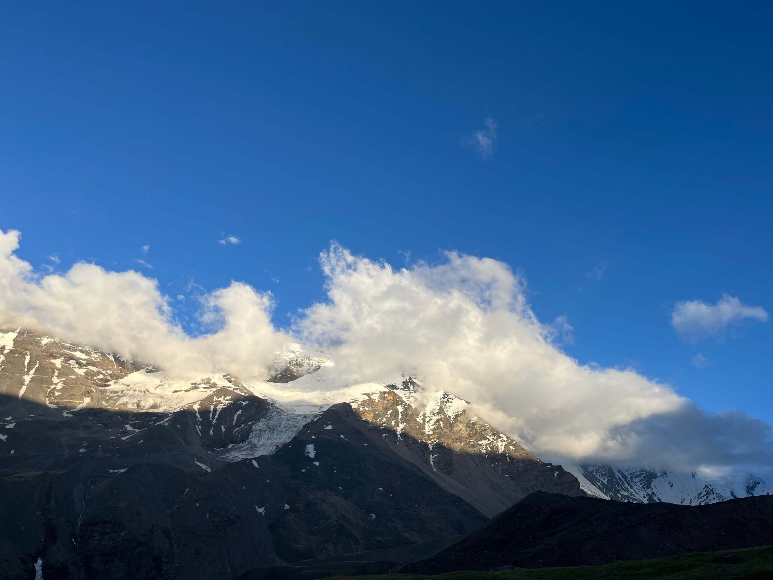
The breathtaking views of the peaks around will feel as if you are walking across a dreamland. With every passing day, the terrain becomes more rugged and nature unfolds itsraw beauty before you. The Kedarnath dome, Jogin, other peaks and also the lakes offer so much beauty as if you are entering a new chapter now and then.
Read Our
Short Itinerary
Day 1
Dehradun to Gangotri (3100 m) - 8 hrs. drive
Day 2
Gangotri to Nala Camp (3750 m) – Trek for 5-6 hrs. (9-10 km)
Day 3
Nala Camp to Rudgaira Base Camp (4350 m) - Trek for 7-8 hrs. (7-8 km)
Day 4
Rest Day at Rudgaira Base Camp
Day 5
Rudgaira Base Camp to Auden’s Col Base Camp (4900 m) – Trek for 6-7 hrs. (7-8 km)
Day 6
Auden’s Col Base Camp to Khatling Glacier via Auden’s Col (5490 m) – Trek for 10-12 hrs. (10-12 km)
Day 7
Khatling Glacier Camp to Zero Point (3900 m) – Trek for 7-8 hrs. (9-10 km)
Day 8
Rest Day at Zero Point
Day 9
Zero Point to Chowki (3400 m) – Trek for 5-6 hrs. (8-9 km)
Day 10
Chowki to Masar Tal (3675 m) – Trek for 4-5 hrs. (6-7 km)
Day 11
Masar Tal to Vasuki Tal (4135 m) – Trek for 6-7 hrs. (10-11 km)
Day 12
Vasuki Tal to Kedarnath (3585 m) – Trek for 5-6 hrs. (8-9 km)
Day 13
Kedarnath to Gaurikund (1982 m) – Trek for 5-6 hrs. (16 km)
Day 14
Gaurikund to Dehradun – Drive for 9-10 hrs. (250 km)
Read Our
Detailed Itenerary
Day 1: Dehradun to Gangotri (3100 m) – 8 hrs. drive
The objective of the first day is to reach Gangotri from your desired location (as per the package). If you are travelling from Dehradun, you can be assured of the amazing views along the way. The small villages, towns and the majestic Bhagirathi River will show you the route towards Gangotri. Once you reach the Gangotri guesthouse, freshen up and rest well. Evening snacks will be provided while the Trek Leaders of Discovery Hike provide you briefing about the next few days. Spend time outside the room to get acclimatized better. You can visit the local market and the famous Gangotri Temple. After having dinner, you will be spending the night at Gangotri.
Day 2: Gangotri to Nala Camp (3750 m) – Trek for 5-6 hrs. (9-10 km)
You must be excited today, as your journey begins today. After finishing breakfast, we will start the trek towards the Nala camp, which is our first campsite. It is a 10 km trek and will take us around 5-6 hours. The Bhagirathi River flows along the trail while you cross dense coniferous forests and beautiful green meadows. After a while, we will enter the Rudgaira Valley and witness the breathtaking view of the Rudgaira peaks following a gradual ascent. The Nala campsite is surrounded by towering peaks and panoramic mountain ranges. We will spend the night here.
Day 3: Nala Camp to Rudgaira Base Camp (4350 m) – Trek for 7-8 hrs. (7-8 km)
The trek today will be steep and the terrain will be full of loose rocks. Once we leave the treeline behind, the Gangotri III and Jogin II will welcome you into their territory. The trek tothe Rudgaira Base Camp is around 8 km and will take us 8 hours to complete. The rocky path will take you towards the campsite which in itself is quite adventurous. The Rudgaira campsite is situated amid rugged cliffs and glaciers. Click as many photographs as possible and acclimatize well. After finishing the dinner, we will spend the night here.
Day 4: Rest Day at Rudgaira Base Camp
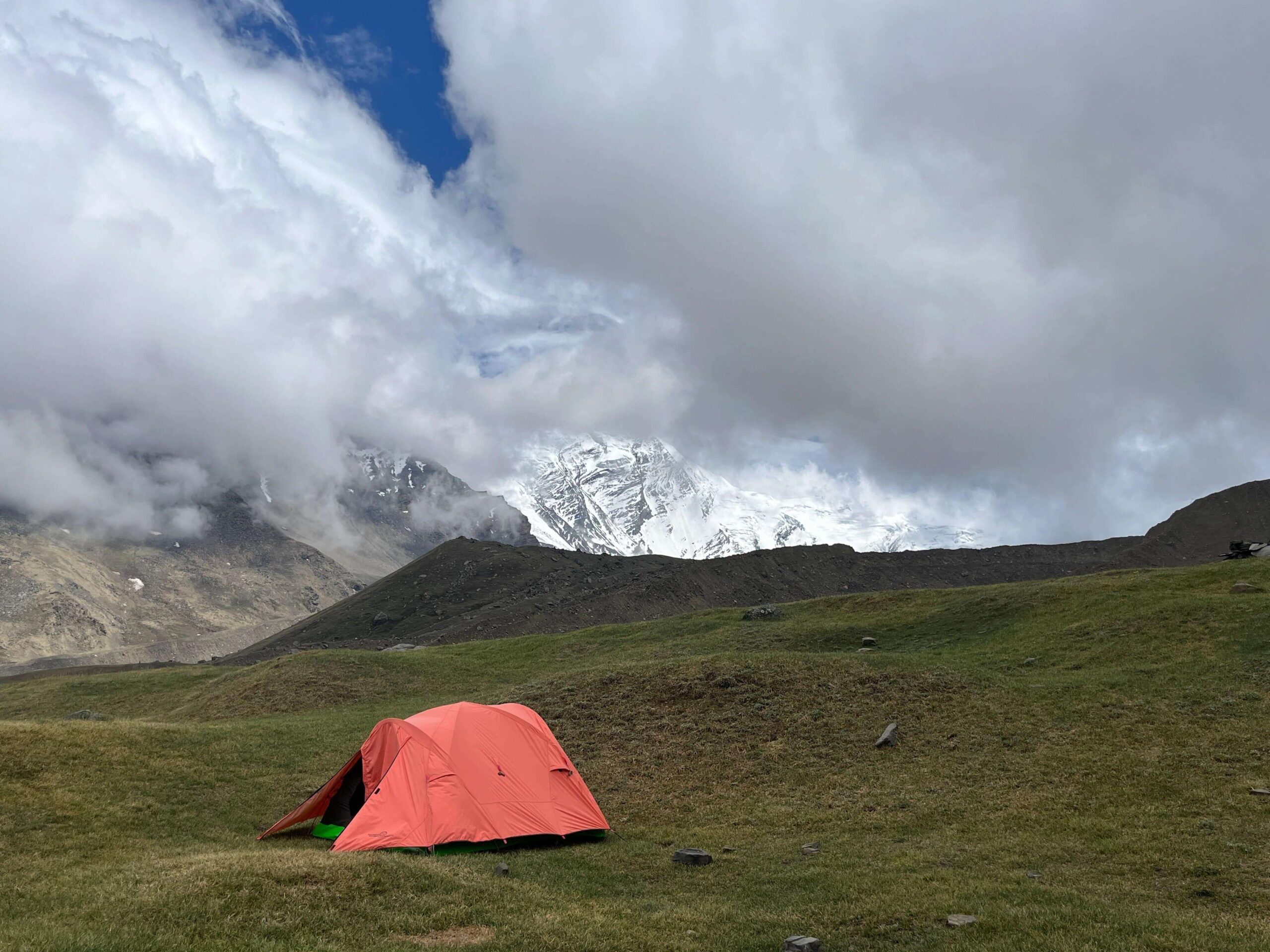
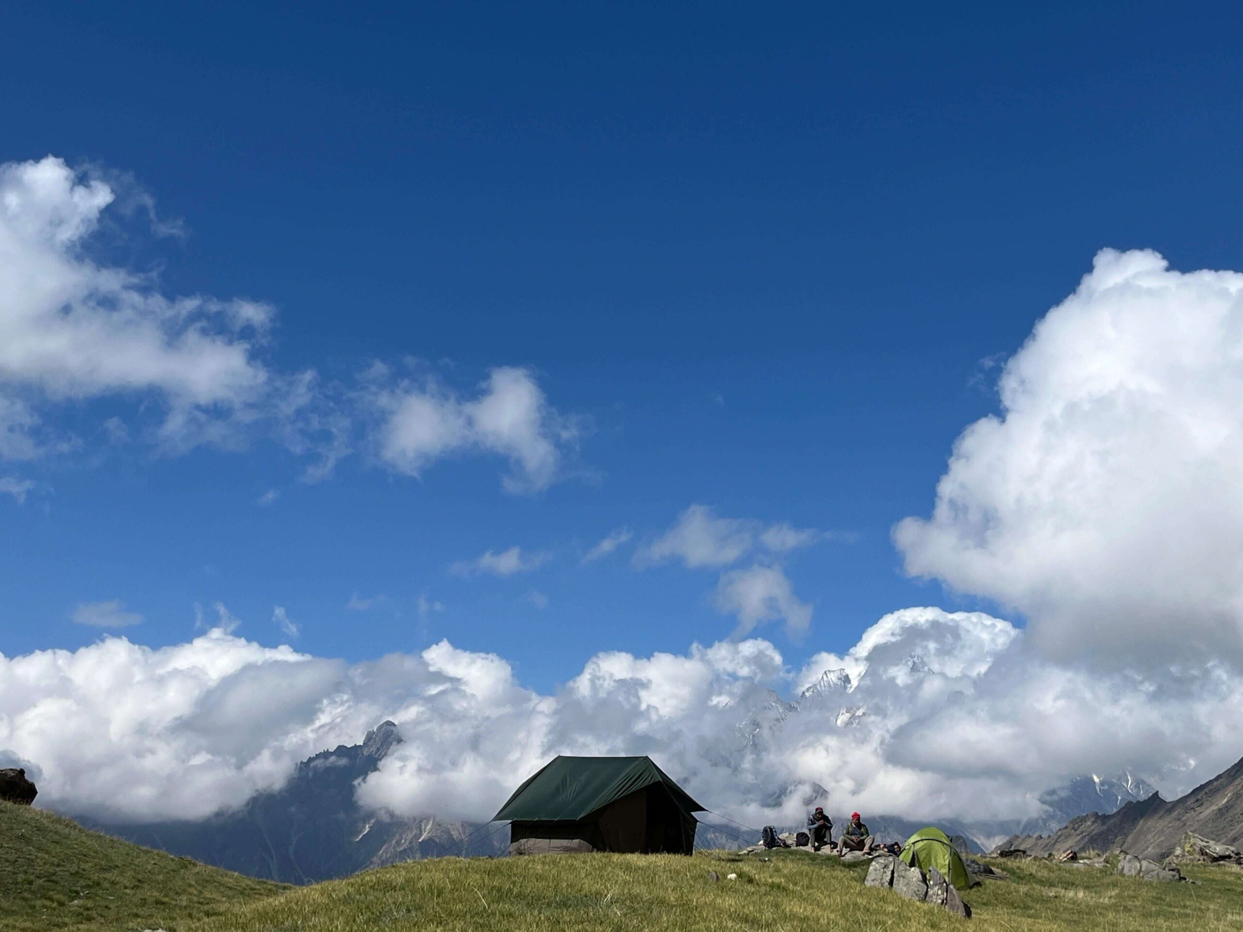
This is a rest day at the Rudgaira Base Camp. Enjoy your day by getting soaked into the Himalayan beauty but don’t forget to prepare your body and mind for the challenging days ahead. The glimpses of the Auden’s Col Summit can be visible, which will give you goosebumps. Listen to the instructions of the Trek Leaders and meditate outside the camps. This ensures mental calmness and better acclimatization for the Summit. Finish your dinner and rest well.
Day 5: Rudgaira Base Camp to Auden’s Col Base Camp (4900 m) – Trek for 6-7 hrs. (7-8 km)
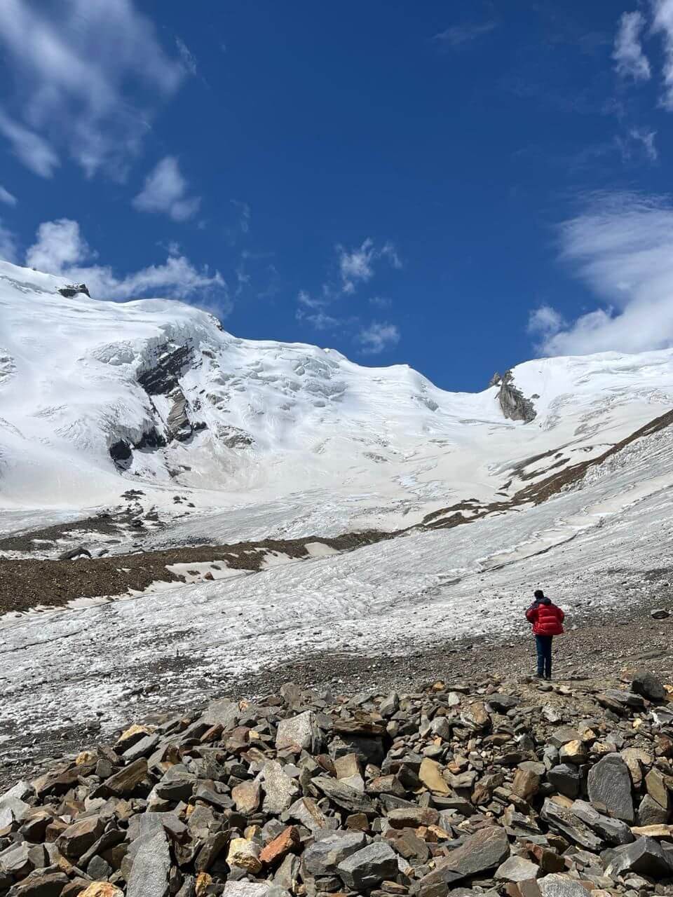
It will be an 8 km trek towards the Auden’s Col Base Camp and will take us around 6-7 hours. The trail will be full of boulders as it moves across glacial moraines and vast snowfields. After a while, there is a gradual ascent but crossing the ridges can be a bit tricky. A lake named the Sukha Tal is also one of the attractions which we will be witnessing today. Once we reach Auden’s Col Base Camp, the challenging Auden’s Col route can be visible while the Gangotri Massif is in the background.
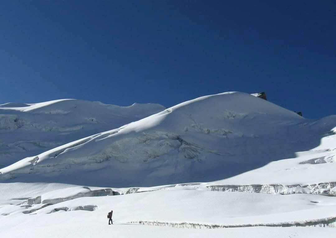
Day 6: Auden’s Col Base Camp to Khatling Glacier via Auden’s Col (5490 m) – Trek for 10-12 hrs. (10-12 km)
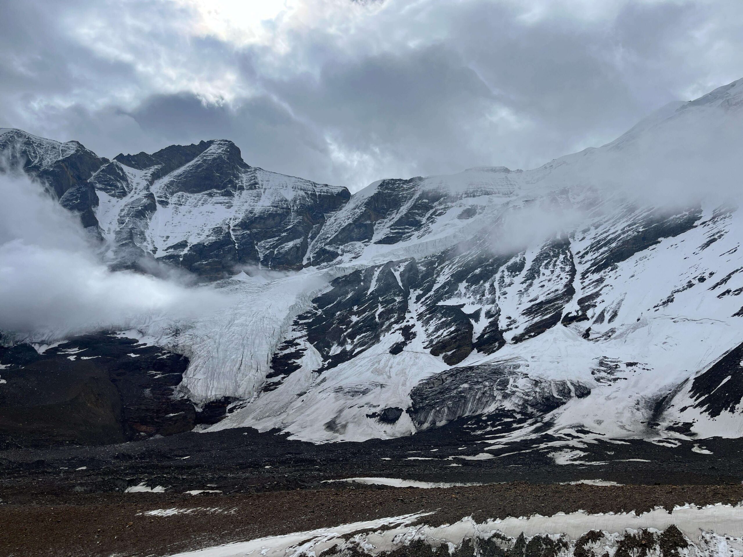
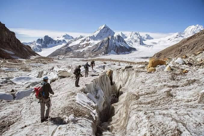
Finally, the day arrives when we reach the Summit of Auden’s Col. It is going to be a long strenuous day as we will be trekking for about 10-12 hours before reaching the Khatling Glacier Camp. The steep ascent towards Auden’s Col will follow panoramic views of Bhilangana Valley from the Summit. The steep technical descent follows afterwards across crevasses and narrow rocky patches. Finally, we reached the Khatling Glacier Camp and relished the achievement of Auden’s Col with the team members. You have overcome the toughest part of the trek, so relax and rest well.
Day 7: Khatling Glacier Camp to Zero Point (3900 m) – Trek for 7-8 hrs. (9-10 km)
We need to move towards the Zero Point Camp, which is a 10 km trek and takes us around 7-8 hours to complete. Today, we will be crossing the Khatling Glacier which is full of glacial moraines, crevasses and challenging terrain. But the terrain gets easier as we move towards grasslands and finally reach the Zero point. The campsite is extremely peaceful and surrounded by rugged terrains and peaks.
Day 8: Rest Day at Zero Point
The last few days were extremely challenging; therefore, it is important to rest today at the Zero Point Camp. Absorb the beauty as much as you can, click photographs and rest well.
Day 9: Zero Point to Chowki (3400 m) – Trek for 5-6 hrs. (8-9 km)
Today, we will be travelling to Chowki which is around 9 km and will take us about 6 hours to reach. The Bhilangana River shows us the way towards Chowki through green meadows and a few rocky patches. After a while, the terrain becomes easy as we start entering the vast grasslands. Finally, we reach the Chowki campsite which is very photogenic as it is situated in a beautiful valley.
Day 10: Chowki to Masar Tal (3675 m) – Trek for 4-5 hrs. (6-7 km)
It is a 7 km trek today, which will take us through a gradual ascent towards the Masar Tal. The Masar Tal is a beautiful high-altitude alpine lake amid towering Himalayan mountains. The lake reflects the image of the mountain landscape, which enhances the beauty even further. The place is a perfect combination of beautiful greenery and rocky terrains.
Day 11: Masar Tal to Vasuki Tal (4135 m) – Trek for 6-7 hrs. (10-11 km)
The trail towards the Vasuki Tal is steep and there are many rocky patches. The views from the Vasuki Tal campsite are mesmerizing. The place is also of high spiritual value as it is named after the Snake God, Vasuki. At this point, you might feel quite enthusiastic as Auden’s Col Trek is almost complete. The beauty of the Vasuki Tal might feel like reaping the fruits of all the hardships that you went through, during the last few days.
Day 12: Vasuki Tal to Kedarnath (3585 m) – Trek for 5-6 hrs. (8-9 km)
The day arrives when we reach the much-awaited Kedarnath. The trail to the Kedarnath Temple begins with a rocky descent which transitions into the meadows. It is a 9 km trek and will take us around 6 hours to reach. People are often emotional after seeing the historic Kedarnath Temple, especially after such a strenuous journey. Get soaked into the mountain landscape around you and engage in the evening prayer at the temple.
Day 13: Kedarnath to Gaurikund (1982 m) – Trek for 5-6 hrs. (16 km)
After finishing breakfast, we begin the tail of the Auden’s Col Trek. The Mandakini River will guide us through the final descent of the trek towards Gaurikund. The trail is a twisty route through the coniferous forests surrounded by alpine valleys and towering peaks. Once, we reach Gaurikund, you are filled with a heavy heart and mixed feelings. Although you feel a sense of accomplishment you miss the natural beauty, the terrains and the entire experience.
Day 14: Gaurikund to Dehradun – Drive for 9-10 hrs. (250 km)
Today is the last day of Auden’s Col Trek. The Discovery Hike Team will take you to your desired location (as per the discussed package) and finally, you can reach your respective abode.
Read
Altitude Profile Chart
The following graph will visually represent the altitude gains across the various campsites.
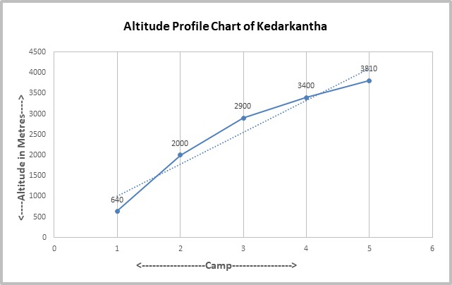
Here X-axis shows the following campsites listed below.
The Y-axis shows the altitudes.
- Gangotri
- Nala Cam
- Rudgaira Base Camp
- Auden’s Col Base Camp
- Auden’s Col
- Khatling Glacier Camp
- Zero Point
- Chowki
- Masar Tal
- Vasuki Tal
- Kedarnath
- Gaurikund
Check
Route Map
Read
Inclusion
- Transportation: Dehradun to Gangotri on Day 1 and Gaurikund to Rishikesh/Dehradun on Day 14.
- Accommodation: Stay is included from Day 1 to Day 13. You will be staying at a guest house in Gangotri, Kedarnath, Gaurikund and in camping tents on other days.
- Meals: All meals from dinner at Gangotri on Day 1 to breakfast at Gaurikund on Day 14 are included. We provide simple, nutritious vegetarian food on all days of the trek.
- Camping charges: All trekking permits and forest camping charges are included.
- Trekking equipment: You will stay in high quality tents and sleeping bags in all the camps.
- Safety equipment: First aid and medical kit will be carried by our trek leaders and guides.
- Services of an expert Trek Leader: The trek leaders are qualified in mountaineering and first aid courses.
- Services of an expert Trek Team: The mountain staff on this trek consists of well-trained guides, cook and helpers.
Read
Exclusion
- Food during vehicle transit to Dehradun: The trek fee does not include meals purchased during the road journey to Sankri from Dehradun and back from Chitkul.
- Backpack offloading charges: If you wish to offload your backpack, there will be an additional charge of Rs 1,000 per bag per day (Day 2 to Day 13). The backpack cannot weigh more than 10 kg. Suitcases/trolleys/duffel bags will not be allowed. Please note that it may not be possible to offload the bag while already trekking on the route. It is advisable to inform in prior.
- Stay at Dehradun, Rishikesh.
- Personal expenses of any kind.
- Any medical emergency/evacuation/rescue will be assisted by our team but the additional charges for change in plans are to be borne by the trekker(s) concerned.
- Anything apart from inclusions.
Read
Other Information
Typical items included in the meals are:
- Breakfast: Wake-up Tea/Coffee, Biscuits, Aloo Paratha with Achaar, Boiled Egg, Bread with Butter/Jam, Fruit, etc.
- Lunch: Roti/Chapati, Rice/Chawal, Manchurian Rice, Salad, Dal (Rajma), Mixed-Veg, Kofta Curry, etc.
- Snacks: Tea, Coffee, Pakoda, Finger Chips, Veg Cutlet, Maggi, Soup, Popcorn, etc.
- Dinner: Roti/Chapati, Rice/Chawal, Matar Paneer, Mixed Dal, Salad, Papad, Sweets (Gulab Jamun, Jalebi), Fruit Custard, etc.
Weather and Climate Info:
Summer (April – June)
Accessibility
The trail is accessible.
Weather Conditions
The weather is cool with favourable temperatures which range from 10°C to -5°C.
Overview
Best time for trekking because of clear skies, lush green meadows and colourful wildflowers.
Monsoon (July – September)
Accessibility
Tough conditions during the monsoon season.
Weather Conditions
Moderate to heavy rainfall is common and temperature ranges from 10°C to -10°C.
Overview
Trails can be slippery and increase the risk of skidding. Overflowing of the rivers and landslides are common as well.
Autumn (October – November)
Accessibility
You can visit the Auden’s Col Trek in the Autumn.
Weather Conditions
Freezing temperatures which range from 5°C to -15°C.
Overview
The natural beauty is mesmerising. An ideal time for photography and spotting the wide variety of flora and fauna in the Gangotri and Kedarnath valleys.
Temperature Overview
Summer (May to June)
Daytime temperatures: 10 °C
Nighttime temperatures: -5 °C Monsoon (July to September)
Daytime temperatures: 10 °C
Nighttime temperatures: -10 °C
Autumn (September to November)
Daytime temperatures: 5 °C
Nighttime temperatures: -15 °C
Mountain Ranges, River Valley & Lake
Mountain Ranges
The trail of the Auden’s Col Trek is surrounded by many mountain ranges which contrasts well with the white snowfields. The ranges include Gangotri I, II, III and IV, Bhagirathi I, II and III. The Jogin peaks and the Kedarnath dome also make up the mountain landscape at the tail section of Auden’s Col Trek.
River Valley
The Bhagirathi and Mandakini River valleys make up the primary river valleys in the Auden’s Col Trek. The trekkers can get the opportunity to witness the vast greenery if they are travelling in June as the weather is favourable. The wildflowers also add a variety of colours to the green landscape.
Lake
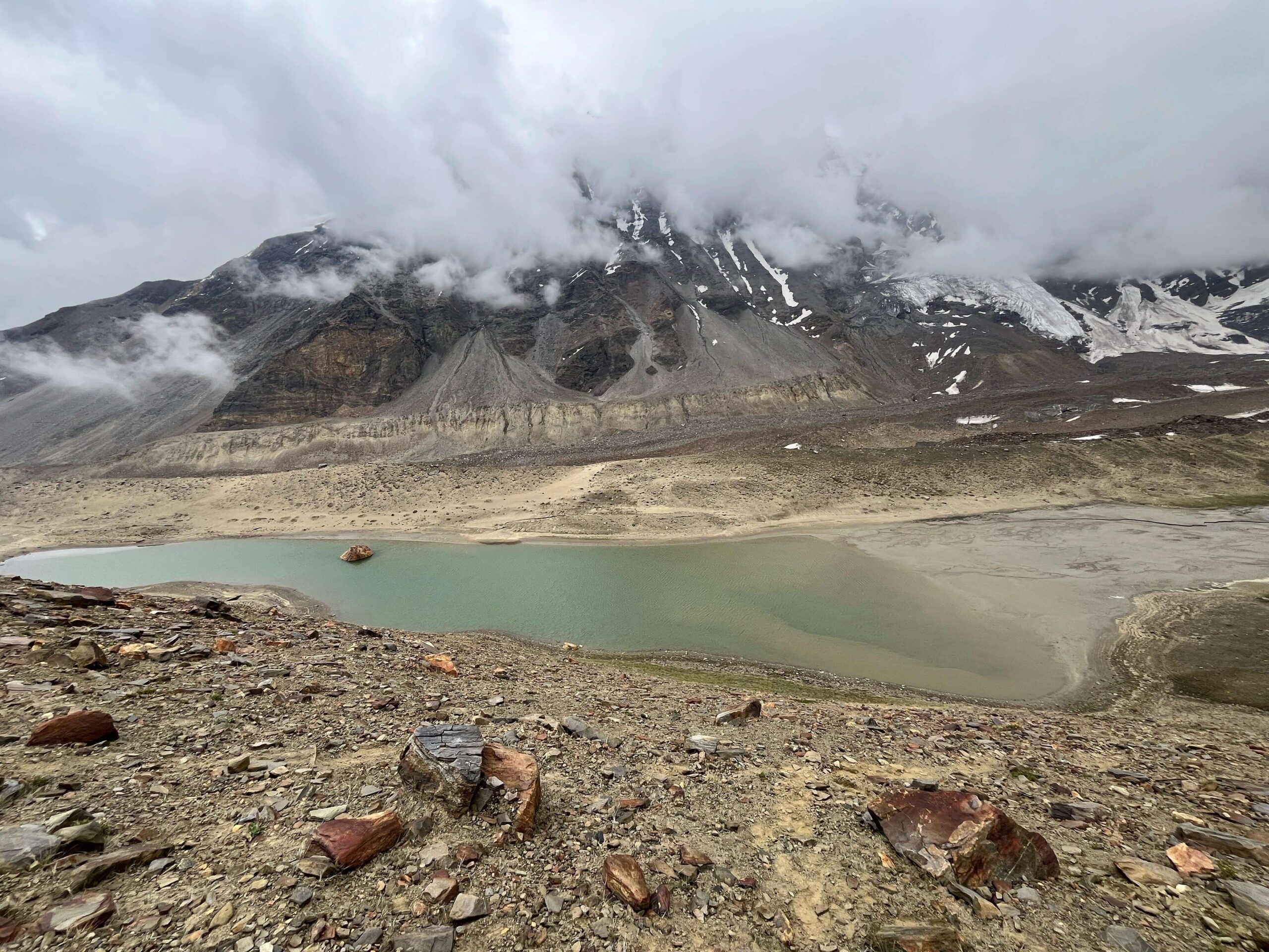
The entire trail has 3 major lakes – the Sukha Tal, the Masar Tal and the Vasuki Tal. The Sukha is the smallest of the three and is situated on the trail between Rudgaira Base Camp and Auden’s Col Base Camp. The Vasuki Tal holds the highest spiritual value as it is named after the Snake God, Vasuki. The Masar Tal is the most peaceful lake as it is in the midst of a valley and is surrounded by towering mountains.
Geographical Highlights
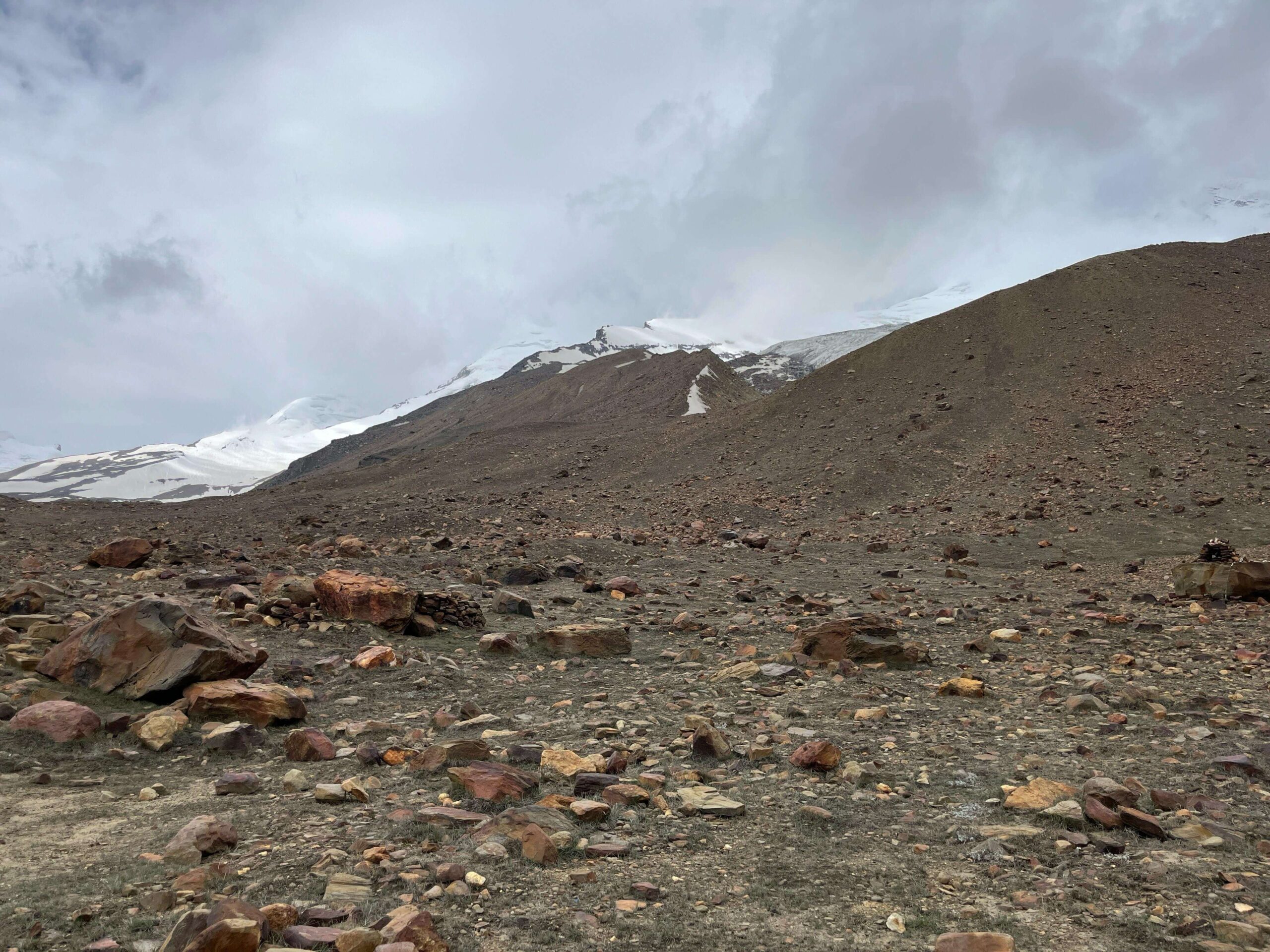
Glacial Moraines
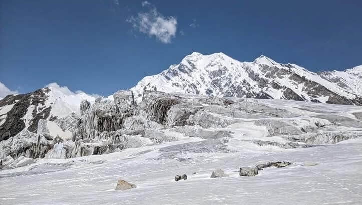
The Auden’s Col Trek is an extremely challenging trek and therefore, glacial moraines are common throughout the trail. The trekkers should look forward to some of the major moraines which include Rudgaira Glacier, Khatling Glacier and Gangotri Glacier. The Gangotri Glacier is among the largest glacial moraines in India. The Khatling Glacier is filled with ice ridges and wide crevasses, making the journey more strenuous and exciting. The Rudgaira Glacier form the foot of the Jogin peaks.
Alpine Meadows
The meadows near the Chowki campsite are known as the Chowki Bugyal. It is filled with pink, red and white coloured flowers and lush greenery. The winter covers the wide grasslands with a thick sheath of snow, making it a white snowfield.
High-altitude Passes
The Auden’s Col is the primary high-altitude pass located on this trek. It sits at an altitude of 5490 m. The trail from the Auden’s Col Base Camp is steep towards the pass. There is another pas called the Mayali Pass, which is an alternate route towards Kedarnath. The trekkers can explore the Mayali Pass if they wish to.
Flora and Fauna
Flora
Forests
The lower parts of the trek are filled with dense coniferous forests. The large canopies of the trees protect the trekkers from the scorching heat. The trees include pine, fir, birch and oak.
Flowers
The flowers are mostly seen in the meadows. Occasional sights of the colourful wildflowers can also be found along the trail. Bright red Rhododendrons are common in the Auden’s Col Trek. Brahma Kamal can also be found, which is the State flower of Uttarakhand.
Fauna
Mammals
The Himalayan Black Bear is quite common in Auden’s Col Trek, especially in the lower sections. These bears can be spotted alone or with their young ones. The Musk Deer can also be seen in the forest areas but are quite rare. The Himalayan Blue Sheep are common on rocky terrains in the higher altitudes. Their predators, the Snow Leopard, which is very rare, can also be spotted in the rocky patches of the Auden’s Col Trek.
Birds
The Himalayan Monal, the State Bird of Uttarakhand, is the most common in the entire trek. It is characterized by its beautiful coloured feathers. The massive Golden Eagle also attracts attention because of its large wing span and size. The mammals living in the valleys fall prey to these eagles. The Bearded Vulture is common in the higher altitude, scavenging across the entire terrain.
Photography Tips
Golden Hours for Lighting:
Tip: Leverage the stunning lighting conditions during the golden hours – early morning and late afternoon. Capture soft and golden light that enhances the beauty of the landscape. Avoid midday when the light can be harsh, but it can also create compelling contrasts in the rugged terrain.
Flora and Fauna Focus:
Tip: Explore the rich biodiversity. Capture vibrant rhododendrons in spring, lush greenery in monsoon, and snow-covered trees in winter. Use a zoom lens for wildlife shots, maintaining a safe distance to avoid disturbing the animals.
Landscape Photography Essentials:
Tip: The panoramic views of the Himalayas are breathtaking. Keep a wide-angle lens handy to capture the vast landscape. Add depth and scale by incorporating elements like trekkers or tents in the foreground.
Experiment with Perspectives:
Tip: Vary your angles and perspectives for unique shots. A low-angle shot of a trail leading into the mountains can add depth and intrigue to your photos. Experimentation can lead to captivating compositions.
Rule of Thirds:
Tip: Compose balanced and interesting shots using the rule of thirds. Divide your frame into nine equal segments and place key elements along these lines or their intersections. This simple rule can significantly enhance the visual appeal of your photographs.
Capture Local Culture:
Tip: As Auden’s Col Trek passes through quaint villages, document local architecture, people, and daily life. Seek permission before photographing individuals to respect their privacy and cultural norms.
Night Sky Photography:
Tip: Utilize the clear skies at high altitudes for astrophotography. Set up a tripod and use long exposure settings to capture the stars, and potentially the Milky Way. The serene nights in the Himalayas offer a canvas for stunning celestial shots.
Be Weather Prepared:
Tip: The Himalayan weather is unpredictable. Protect your camera equipment from rain and snow using weather-resistant gear. Keep batteries warm in cold weather to prevent quick drainage. Consider using lens hoods and covers for additional protection.
Travel Light:
Tip: Prioritize essential gear for high-altitude trekking. Minimize equipment to reduce the weight you carry. A lightweight and versatile camera setup will ensure you are agile and ready to capture spontaneous moments.
Respect the Environment:
Tip: Be mindful of your surroundings. Avoid damaging the natural environment or disturbing wildlife while capturing your shots. Leave no trace and follow the principles of responsible trekking and photography.
Bonus Tip – Patience is Key:
Tip: Sometimes, waiting for the right moment, light, or movement can make a significant difference in capturing a memorable photograph. Practice patience during your trek, and you might be rewarded with extraordinary shots that tell a unique story of your Auden’s Coladventure.
Things to Carry
Hiking Shoes
Type: We recommend that you have to look for shoes that are water-resistant and have a deep yet flexible sole to sustain on Himalayan terrains.
Note: Dynamic rough terrains hold uncertain threats. The pair of shoes that has the advantage of overcoming those threats will help you to maintain your confidence in balancing.
Backpack
Type: It purely depends on the kind of Trek you are planning to do.
(15-20) litres will be ideal for short treks of (1-3) days.
(40-60) litres will be ideal for long treks of (3-10) days.
Note: A backpack comes under very essential for the activity like trekking. You will have a requirement of your Backpack throughout the journey for your belongings and all the essentials you need. We recommend you test the bag and choose it according to your height, the Trek where you are taking it & and the comfort it provides.
Daypack
Type: A (10-15) litres waterproof daypack is all you need to have with you for the Summit.
Note: Your Daypack will be for those Summit days and shorter days when you just need your essentials (wallet, small water bottle, sunglass, power bank, etc.) with you.
Clothing
Collared T-shirts – Carrying 2 – 3 units of collared T-shirts will be ideal. The collar will help you to keep your neck away from direct sunlight and not too exposed to the Sun and getting sunburnt.
Padded Jacket – Ensure that the jacket is wind-resistant & and capable of keeping you warm at -10 °C to -12 °C temperature.
Fleece Jacket – Fleece jackets are made of very soft and cosy material. It helps you to maintain a comfortable body temperature. Keep 2 Fleece Jackets with you.
Thermals – You will have a requirement of only 1 pair of this in the Winter, For Summer it could be under consideration. It is made of pure cotton and designed in such a way that body heat is blocked between its layers. It will keep you warm during the nights when the temperature falls.
Trek Pants – You will have a requirement of 2 units of Trekking Pants with you always. Between them, one must be convertible. Ensure it is made of Cotton or windproof light material & and provides maximum durable comfort.
Sun Caps –The Sunlight might be harsh at higher Altitudes and the direct exposure of sunlight to your head harms your skin. Carry Sun Caps to keep your head cool.
Woollen Caps – You will need woollen caps during the nights to keep your ears and head warm from the very cold breeze.
Waterproof Gloves – You will require waterproof gloves for cold and wet sections of the Trek. Always keep your hands clean and warm, avoid letting your hands wet to get the supporting grip and balance.
Trek Accessories
Trekking Pole: The Trekking/Hiking Pole saves 60% of your energy for conquering a steep slope at a higher altitude. It is advisable to carry a trekking pole with you for the treks.
Head-lamp or Torch: A head-lamp is another important thing that also comes under mandatory items for our Treks. It will help you to deal with the dark. Headlamps become more effective to walk in dark cold weather without approaching through your hand. Featured Torch is also ok for uphill.
Daily essentials
Toiletries: We recommend you carry all your Toiletries essentials and all other personal belongings by yourself to avoid borrowing. Here are some items you could take- tooth-cleaning paste, dental brush, lip moisturizer, skin hydrating cream, facial cleanser, a range of vital creams and items, bathroom tissue/toilet paper, menstrual pads, along with other important personal care items like shampoo, conditioner, deodorant, and shaving supplies.
Containers & Vessels: It’s advisable to bring your water containers; we recommend two bottles each with a capacity of 1 litre. Additionally, for both ease and hygiene reasons, please carry your food containers to use for the meals we supply. The metal bottle comes in handy for hot water served in the camps.
Recommended Medicines:
Gauze 1 small roll, Dexamethasone one strip, Nifedipine 5 tablets, Band-aid 10 strips, Avomine 4 tablets (motion sickness), Avil 25mg 4 tablets (allergies), Combiflam 4 tablets (Pain killer), Crepe bandage 3 to 5 meters, Disprin 6 tablets (headache), Crocin 6 tablets (fever), Digene 10 tablets (acidity), Omez/ Rantadine 10 tablets (antacids), Norflox TZ & Lomofen 6 tablets each (diarrhoea), Diamox 10 tablets (to prevent AMS), Cotton 1 small roll
Essential Documents Required:
For the Auden’s Col Trek, you must bring specific documents and submit them to the trek leader at the base camp. These include a copy of the Disclaimer, along with one photocopy and the original of a government-issued photo ID. Additionally, a doctor’s medical certificate confirming your fitness for high-altitude conditions is required.
Risks and Precautions
Here are the risks or challenges you might face on the Auden’s Col Trek.
Risk of Slip/Skid:
Nature of Risk: The trail, particularly in winter (December and January), may be scattered with black ice, leading to a risk of slipping or skidding. Additionally, the unpredictable Himalayan weather adds to the challenge.
Safety Precautions:
Briefing session at the base camp regarding slip/skid risks.
You will get a trained trek leader’s guidance on maintaining balance and proper use of trekking poles.
Provision of crampons by Discovery Hike for snow-filled trails, reducing skidding risk by up to 95%.
Continuous awareness communication from the trek leader during the trek.
Choosing trekking shoes with a good grip is crucial.
High Altitude Risks:
Nature of Risk: Ascending from 6,400 feet to 11,500 feet over 4-5 days may lead to Acute Mountain Sickness (AMS), High Altitude Pulmonary Edema (HAPE), and High-Altitude Cerebral Edema (HACE), especially at higher camps.
Safety Precautions:
Start DIAMOX from the first day to reduce AMS risk.
Trained leaders are recognizing AMS symptoms and equipped with a high-altitude medical kit.
Oxygen cylinders are available for safety.
Immediate descent if conditions worsen.
Dealing with Blisters and Cramps:
Nature of Risk: Blisters, cuts, and cramps can occur on uneven trails.
Safety Precautions:
Trekkers to inform the trek leader promptly.
Well-fitting, breathable trekking shoes are recommended.
Treatment kit with trek leader and application of cramp spray for leg cramps.
Weather Risks at High Altitude:
Nature of Risk: Unpredictable weather, particularly in the Himalayas, can worsen quickly.
Safety Precautions:
Trek leader’s decision on continuing or waiting for better weather.
Provision of all-weather tents to cope with different weather challenges.
Communication Risks:
Nature of Risk: Communication signals weaken and may be lost completely at higher altitudes.
Safety Precautions:
Use of walkie-talkies for alternative communication between different campsites.
Emergency/Immediate Rescue:
Nature of Risk: Severe health issues or emergencies may necessitate immediate rescue.
Safety Precautions:
Quick utilization of resources like porters and mules for rescue. *Rescue cost is not included in the package.
Standby team at different campsites for assistance.
Airlifts are arranged in acute cases. *The cost of airlift is not included in the package.
Risk of Low Oxygen at Higher Altitudes:
Nature of Risk: Oxygen levels decrease with altitude, potentially causing breathing difficulties.
Safety Precautions: Availability of oxygen cylinders with the trek leader and staff.
Affected trekkers to inform the leader or descend to a lower campsite for immediate help.
Overall Safety and Cooperation:
Cooperation is essential for safety and enjoyment during the trek. Discourage the use of objectionable substances during the trek for overall safety and well-being.
Cancellation Policy
Initiating Cancellation:
To cancel your booking, please send an email to: [email protected]
Cancellation Due to Unforeseen Events:
In case of trek cancellation by Discovery Hike owing to unexpected events such as natural disasters, floods, or political unrest, we will issue a trek voucher. This voucher is valid for one year and can be used for the same or a different trek.
Cancellation Due to Personal Reasons:
If you decide to cancel your trek for personal reasons, the following terms apply under our cancellation policy:
No Cash Refunds:
We do not offer cash refunds once a booking is completed. Instead, a voucher for the same or a reduced amount will be provided.
Cancellation 30 Days or More Before Trek:
If you cancel 30 days or more before the trek start date, a voucher for the full booking amount will be issued.
Cancellation 20-29 Days Before Trek:
For cancellations made between 20 to 29 days before the trek start date, 50% of the booking amount will be deducted. The remaining amount will be provided as a voucher.
Cancellation Less Than 20 Days Before Trek:
No voucher will be issued for cancellations made less than 20 days before the trek start date.
Seasonal and Occasional Activities
The seasonal and occasional activities are important to understand as they may help the trekkers to understand the region and its culture better. The trekkers can also engage in several local activities and explore different opportunities to connect with people and their traditions. Some of the activities have been explained for the trekkers to gain a new perspective about the Auden’s Col Trek.
Seasonal Highlights
Summer (June to August)
The snow melts during the summer season which allows the trekkers to have clear visibility of the trail and the surroundings. The meadows are filled with greenery and blooming wildflowers. The streams and rivers also flow rapidly because of the melting snow.
It is a good opportunity to spot various wildlife, especially some of the rare animals like Snow Leopard and Musk Deer. The summer unveils a different layer of nature’s beauty before the trekkers.
Autumn (September to November)
The Autumn offers the best views of the different peaks and mountain ranges around. This is the best time for birdwatching and photography as well. The skies are clear and the weather is favourable. The meadows turn brown which looks amazing, especially through a lens.
The temperatures can be low, therefore, the trekkers should visit Auden’s Col Trek in the Autumn with enough prior preparation. Extra warm clothes should be carried and layering should be given importance.
Monsoon (June to September)
The Monsoon Season should be strictly avoided for visiting the Auden’s Col Trek or any other trek as the trails become slippery and visibility is reduced. Landslides are common and the rivers and streams turn aggressive as well.
Occasional Activities
Ganga Dussehra
The downpour of the holy Ganga River from heaven is celebrated on this occasion. The devotees offer their tribute by taking a dip in the Bhagirathi River, which symbolises cleansing. Multiple fire rituals also form a part of the Gaga Dussehra.
Badri-Kedar Utsav
The festivals mainly focus on the cultural celebration of Lord Shiva. Rituals and traditional music are performed at the Badrinath and Kedarnath Temples. Classical dance and religious chants are also done as an offering to Lord Shiva.
Camping
There are many camping destinations in the entire trek. Therefore, camping lovers will enjoy Auden’s Col Trek to the fullest. Star gazing and enjoying local food at the campsites can notbe put into words, if not experienced.
Photography and Birdwatching
Along the way, the trails offer many opportunities for the trekkers to capture endless memories. The rest days at the campsites can be used primarily for astrophotography and Birdwatching. If one is patient, he can easily capture the Himalayan Monal or the Golden Eagle.
Local Language Phrases:
Hello – “नमस्कार” (Namaskar)
How are you? – “तुम कसै छौ?” (Tum kase chau?)
My name is – “मेरु नाम …” (Meru naam …)
I am fine. How are you? – “मी ठीक छौं. तुम कसै छौ?” (Mi theek chaun. Tum kase chau?)
Please help me. – “कृपया, मेरी मदद करें.” (kripya, Meri madad karen.)
Tell me the route. – “मुझे रास्ता बता.” (Mujhe rasta bata.)
Where am I right now? – “मी अभी कख छौं?” (Mi abhi kakh chaun?)
Please rescue me. – “कृपया मुझे बचाओ.” (Kripya mujhe bachao.)
Do you have medical kits? – “क्या तुमरे पास मेडिकल किट छै?” (Kya tumre paas medical kit chhai?)
Will you join me? – “तुम मेरु साथ द्याओलु?” (Tum meru sath dyaolu?)
How long will it take to reach the summit? – “शिखर तक पहुंचण मा कती समय लगोलु?” (Shikhar tak pahunchan ma kati samay lagolu?)
Where is the next Maggi point? – “अगला मैगी प्वाइंट कख छ?” (Agla Maggi point kakh ch?)
Will there be too much cold? – “क्या ज्यादा ठंड ह्वालि?” (Kya jyada thand hwaali?)
What is the name of the nearest village? – “नजीकी गांव का नाम क्या छ?” (Naziki gaon ka naam kya ch?)
Is there any update of heavy snowfall? – “क्या भारी हिमपात कु अपडेट छ?” (Kya bhari himpaat ku update ch?)
Check
Upcoming Batches
May :
1st – 31st May
June :
1st – 30th June
Sep :
1st – 30th Septemebr
Oct :
1st oct – 31st Oct
Check
Our Gallery
Read
FAQ's
The pickup for the Auden’s Col Trek is scheduled at Dehradun/Rishikesh/Haridwar/Kathgodam. The vehicle will wait for a maximum of half an hour or more in case of delays or genuine issues raised by the trekkers.
The best time to undertake the Auden’s Col Trek is June and September to November. These months offer pleasant weather and captivating landscapes.
In summer, temperatures on the Auden’s Col Trek can range from 5°C to 15°C, while in winter, it may drop to -5°C to -20°C.
The trek concludes in Gangotri for the Gangotri-to-Gangotri Package, and we will arrange transport from Gangotri at an additional cost of Rs. 6,000/- which may be shareable if other trekkers are available. Generally, we keep the drop-off vehicle Ready in advance for the Dehradun-to-Dehradun Package. The expected arrival in Dehradun is by 18:30.
Tents are usually shared by three trekkers. If you prefer a two-person tent, you can opt for it at an extra fee of Rs. 2000 per person. Payment for customization needs to be made instantly through Cash/bank transfer.
Discovery Hike will arrange tents and sleeping bags designed for harsh conditions.
An experienced trek leader and qualified staff from Discovery Hike will ensure a safe and comfortable journey.
Normal shoes with good grip and water resistance are sufficient. Crampons and gaiters are provided for specific trail conditions.
No, Auden’s Col Trek is extremely difficult and should be visited only by experienced trekkers who are well-skilled with technical equipment.
Ponchos will keep you dry while trekking, and waterproof tents are provided. It's advised to buy a rain cover for your bag.
Yes, trekking poles are essential, reducing energy expenditure by 60%, especially during high-altitude treks.
Similar treks include Kalindi Khal and Panpatia Col Trek, suitable for experienced trekkers.
No, it's suitable for children aged 15 and above, provided they are fit and can hike around 10km daily.
Generally, there are 3-4 toilet tents in every camp with gender-specific dry pits.
Yes, it's available for Rs 350/- per day per Bag. Trolleys/suitcases are not accepted for offloading.
You can fill your bottle from natural resources like cascades, consulting your trek leader before filling it.
Carry 2 litres daily to stay hydrated.
Good Jio and BSNL networks are available till Gangotri. Charge devices there as there are no points afterward.
Wear layers, including thermals, sweaters, and jackets. Socks and a woollen cap are essential.
Yes, there's a luggage room for storage at Gangotri Base Camp, during the trek.
Basic trekking gear, a declaration, and a medical certificate.
Yes, items like ponchos, poles, jackets, shoes, etc. are available for rent.
A balanced diet varies with altitude, including breakfast items like eggs and parathas, and meals with daal, rice, vegetables, and chapattis. Meal variety is changeable and subject to availability.
Local restaurants and hotels are present along the way to Gangotri, which can be used by the trekkers to freshen up.
₹ 95,000
₹ 80,000 INR 28% off
Per Person
Key Highlights
- ➧ Duration : 14D/13N
- ➧ Elevation : 18,010 ft.
- ➧ Best Time : May, June ,Sept, Oct
- ➧ Pick Up & Drop : Dehradun
Upcoming Batches
For Any Queries
+91-9458118063 | +91-7579480944
Read
Client's Feedback
Verified Phullera Ridge Trek. It was a great experience to trek over phullera ridge with discovery hike. The ridge trek was very very challenging as well as full of excitement. Enjoy those days with nice guide, foods and other facilities that provided by the discovery hike.Posted onVerified Outstanding Behaviour of Ganga, Prakash & the team were very heart warming.. They provide us outstanding foods and accommodation.Posted onVerified Bali Pass ( Discovery Hikes ) If you like to get drenched in nature then this is it ! Bali Pass is full of unexplored jungles, flower valleys, waterfalls, glaciers and wild berries to eat 🤤 All this experience gets even more amazing when you have an experienced crew by your side ! Discovery hikes provide you with an unforgettable experience coz they provide you with great food (tasty) & sweet dish at an altitude you cant expect. Moreover, the survival tips and they take care of your tantrums like a mother 😅 Ganga Rana, Mayank bhaiji & team made our experience more comfortable and we did the summit with moderate ease. Safety wise, it's a heads up with this team. P.S. - If you that guy who lags behind everytime and gets exhausted very easily 😂, Don't worry ! Discovery hikes won't leave you alone ! There is a guide each in the front, middle & back of the group.Posted onVerified Super duper adventurous trip ever Myself Kirti from Delhi...this is my 2nd trek with discovery hike team..Bali pass is a high altitude and long trek which needs everything like medication food shelter washrooms and mental support and motivation....and I must tell Ganga & Govind Rana team provides us everything whatever say variety of food like jalebi, gulab jamun, shahi toast, soup, noodles, pakoda, rajma rice,,there is no ending of food varieties for all days which we never expect from anyone in 16200ft,,,both guys and his team like porters all are very very supportive in all stages,,always they ready to giving his hands to someone's hands for support (jinka ❤️ sensitive h like me),,,,, they never say NO,,,,, I was in need of extra support for trekking and these guys gave me full support from starting to end.....in every step I scared from walking but Govind & Ganga were saying to me "DARNA NAHi JAb MEI HU...kahe darna..mei kheti ok sir😝😝😝....their tents/sleeping bags was good....there was lots of activities between the way like rappling, river crossing,, hiking,, ect....if u like adventure then u should go with this team.... discovery hike team is very hardworking by nature....thankss to alllll Ganga & Govind discovery hike team for Marvelous Adventure I had ever in my life.............we will come back again......seeeuuuuuSooonnn.....Posted onVerified Best treking company in Himalayas One of the finest treking company in Himalayas of India. They serve you the best food more the 4 times a days. Sweets in dinner and very friendly people always ready to solve the problem we face on the trek. Very humble and professional people. Love to trek with ganga and his team. Thank you for the wonderful 👏 experience.Posted onVerified Discovery hike Amazing experience with discovery hike spacial thanks to mr. Ganga rana for providing such a great service with exoerienced guide....i did 3 treks with the company.. Harkidun kedarkantha and balipass... I had a good time on the trail... Five star.. 🖤Posted onVerified Bali pass trek I trek with Discovery Hike on Bali Pass from 3-11 September 2021. I had experienced many treks with different adventure companies but Ganga bhaiya and his team is one of the best in all fronts, he and his very best team take care of us. One of the things that needs to complete a difficult trek is food they provide you excellent food, at such a high altitude their food quality doesn't depreciate. Thanks to Ganga bhaiya, Mayank bhaiya and Govind bhaiya and all the staff of Discovery Hike we made it till end. The very last day is like leaving a family. All the best for future expeditions.Posted onVerified Most recommendable Team....worth time and Money This was the best trip we ever had... although with Ganga as guide trip becomes more and more interesting every time , his motivational and thrilling Stories keep us goin on and on plus food is sth beyond compare as it is very difficult to have good food on very high altitude but they made it..his team is the best, very supportive and friendly. They helped us every time we were exhausted and kept us safe till the last destination which was recommendable job. Looking forward to next trip 🤟🏻🥳Posted onVerified Trek with Discovery Hike is like full paisa vasool. This is my 3rd trek with discovery Hike. Trek with discovery Hike is awesome and memorable. I started my trekking journey from Delhi with my friends and they pick us from Dehradun to Sankri Village by comfortable taxi and provide us very delicious and tasty food. Provide A very helpful, experienced guide. At the high altitude, they provide us very warm nd hygiene tents and sleeping bags. and no one can match their taste in food. Thank uh so much Ganga Rana, Govind bro and all team of Discovery hike for providing us all facilities, delicious food, good memories and lot of fine experience. I'll do more treks with ur team.Posted onVerified Best winter trek with the best people Had an amazing experience with Discovery Hikes. Thanks to Randev Ji Urf Hodda Ji for being an amazing trek guide. 😊Posted on
Checkout
Other Trek