4 Best Treks in the Himalayas We know how it...
Read More
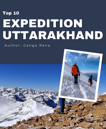
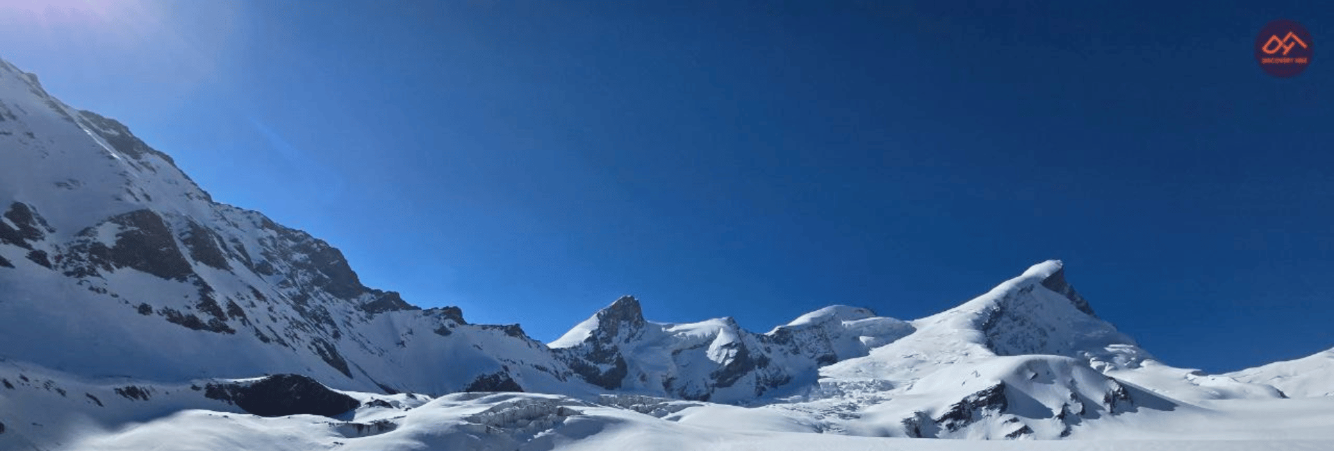
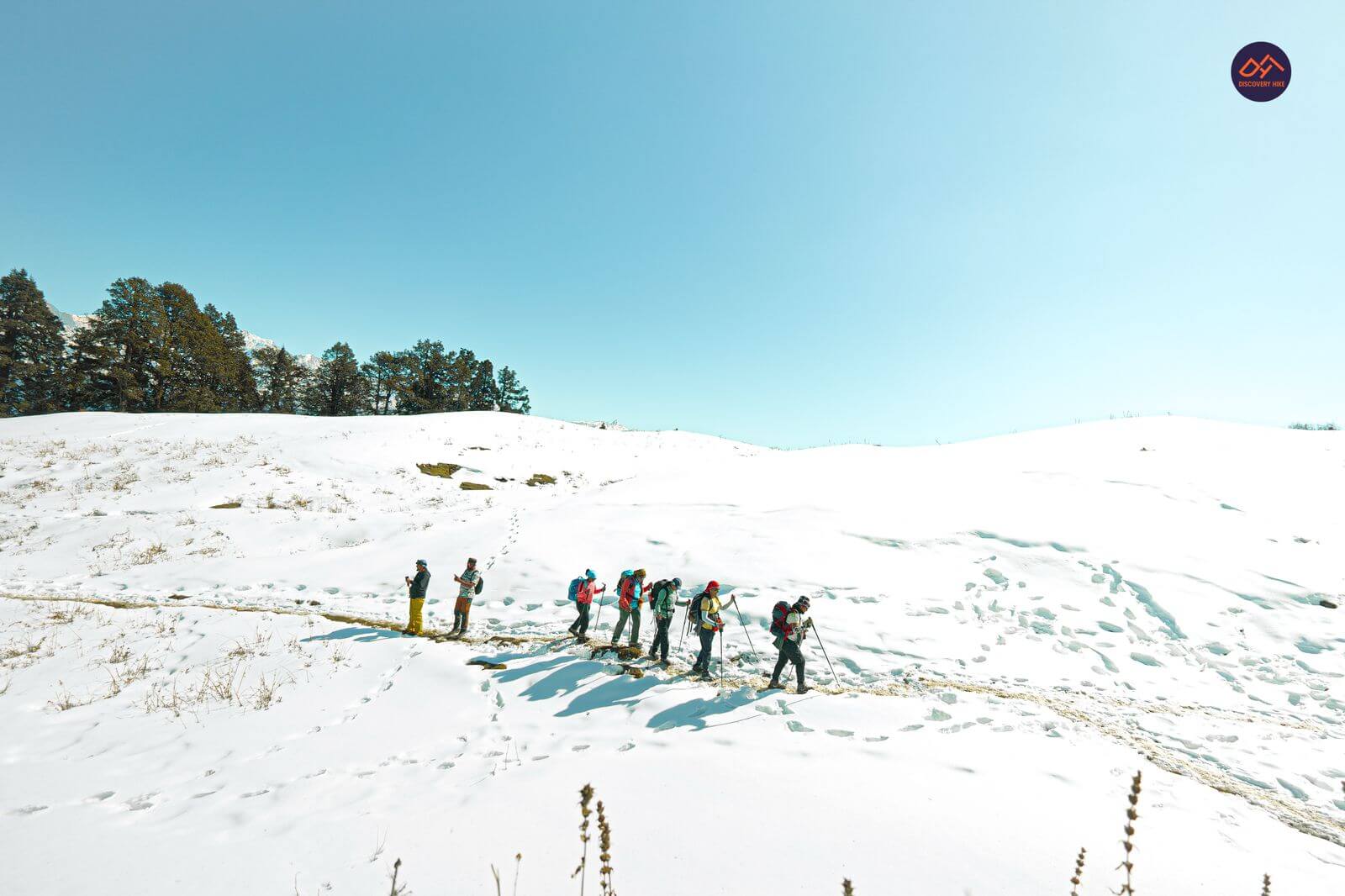
Uttarakhand, nestled in the foothills of the Himalayas, is a mecca for outdoor adventurers looking to spend some time in the great outdoors following the Himalayan peaks. The tranquilly of the countryside, the abundance of holy sites, lakes, and waterfalls, and the peaceful lifestyle of the locals are all part of the trekking experience. You may also easily discover experienced and local trek guides who, with their extensive knowledge, can advise and help you on your trips. Numerous intriguing hiking destinations in Uttarakhand provide breathtaking vistas, making trekking and mountaineering quite popular in Uttarakhand.
- Black Peak Expedition

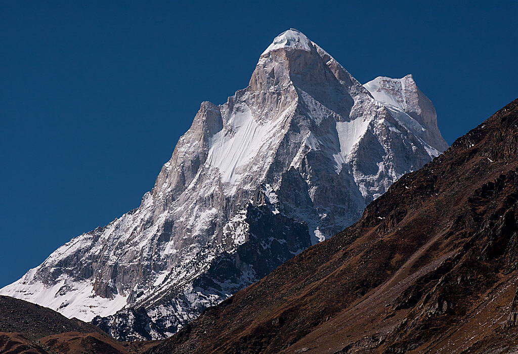
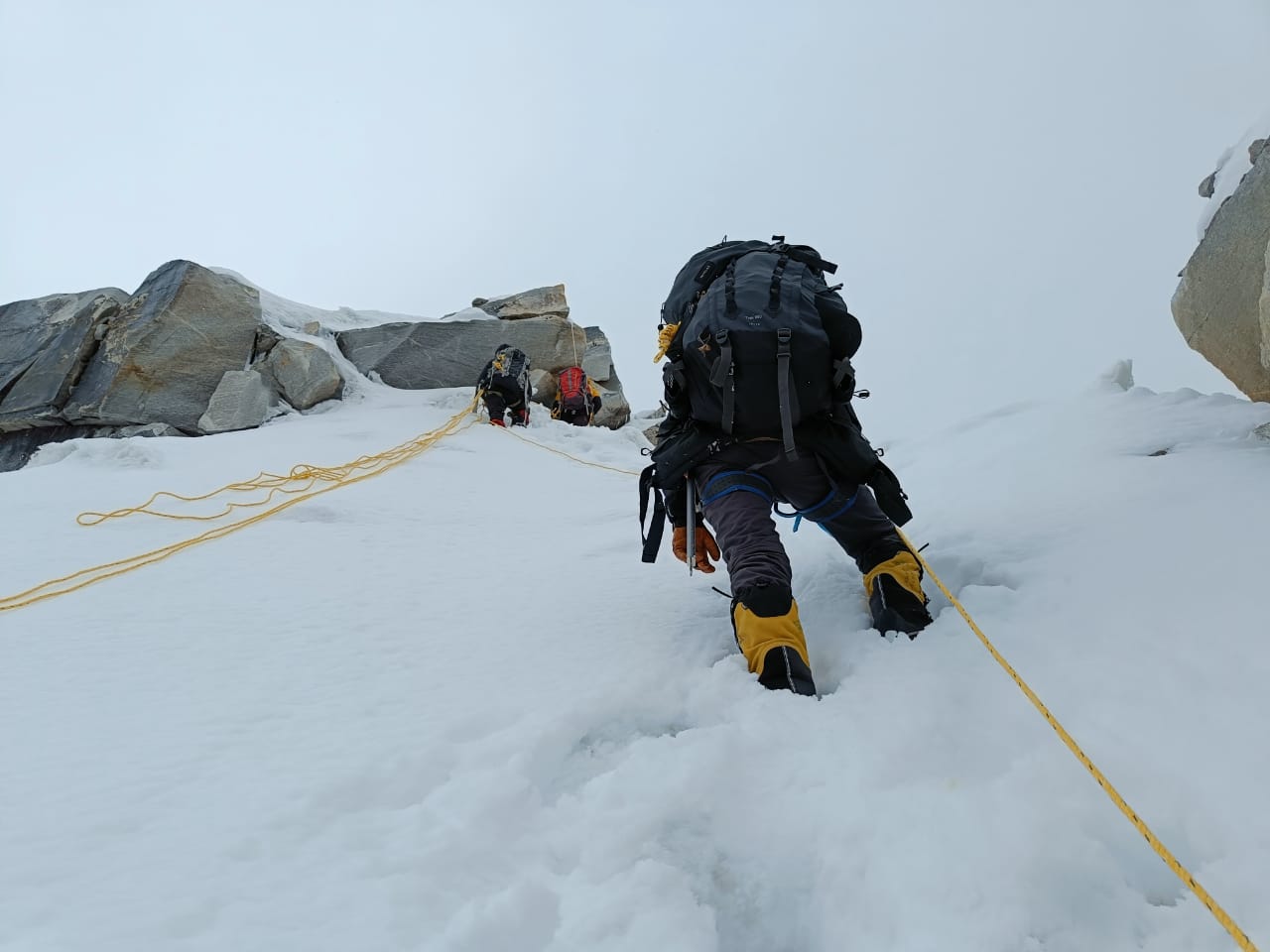
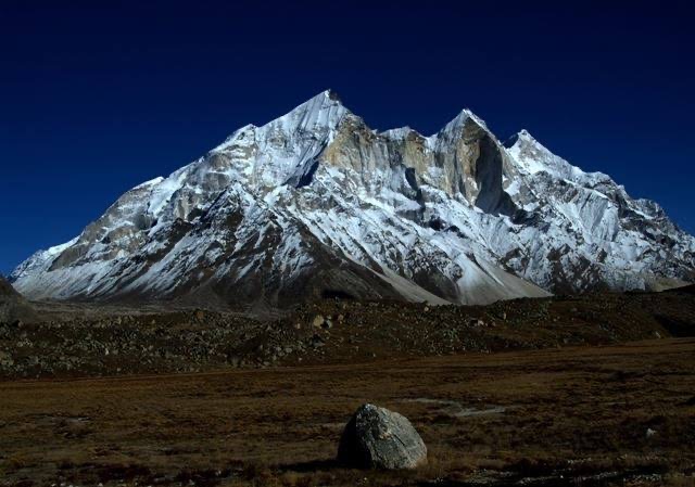
The 6387-meter (20,960-foot) Black Peak is the tallest mountain in the Saraswati range in the Garhwal Himalayas in Uttarakhand, located close to the Ruinsara Valley. Black Peak, or Kalanag as it’s called in the local tongue, gets its name from the fact that its summit looks like the head of a Black Cobra. Of all the peaks that make up the Bandarpunch massif, this one stands out as the tallest and most distinctive. A gentle approach from the southern side of Black Peak leads to an extremely steep summit climb with an almost 70-degree gradient and a 75-foot ice wall, making the route both challenging and tricky. This is a once-in-a-lifetime climb that only the most skilled mountaineers would attempt.
Black Peak is a prominent feature of the Govind National Park region, which is well-known for its unique plant and animal life ( Kalanag ). The trail to the mountain is surrounded by picturesque alpine meadows, pine trees, moraine ridges, stones, and glacier basins. Black Peak is the tallest peak in the range between Saraswati Devi Parvat (Bandarpunch I, 6316 m) and Hanuman Parvat (White Peak or Bandarpunch II, 6102 m), and summiting it will test your mettle as a climber and push you to your limits, but the views from the top will be worth it.
Below down are the short itinerary for Black Peak Expedition:-
- DAY 1 : Dehradun – Taluka(1906m.)
- DAY 2 : Taluka – Osla(2560m.)
- DAY 3 : Osla – Ruinsara Tal (3350m.)
- DAY 4 : Ruinsara Taal – Kyarkoti (Base Camp) 3500m
- DAY 5 : Base Camp – Camp 1 (4600m) Load Ferry
- DAY 6 : Day 6: Base Camp – Camp 1
- DAY 7 : Camp 1 Camp 2 (5100m) Load Ferry
- DAY 8 : Camp 1 – Camp 2
- DAY 9 : Camp 2 – Camp 3 (5500m)
- DAY 10 : Camp 3 – Summit Attempt (6387m)
- DAY 11 : Extra Day reserved for Summit attempt
- DAY 12 : Move to Base camp
- DAY 13 : Base camp – Osla
- DAY 14 : Osla – Taluka – Sankri
- DAY 15 : Sankri – Dehradun – Delhi
For detailed itinerary:- Black Peak Expedition
- Mount Shivling Expedition
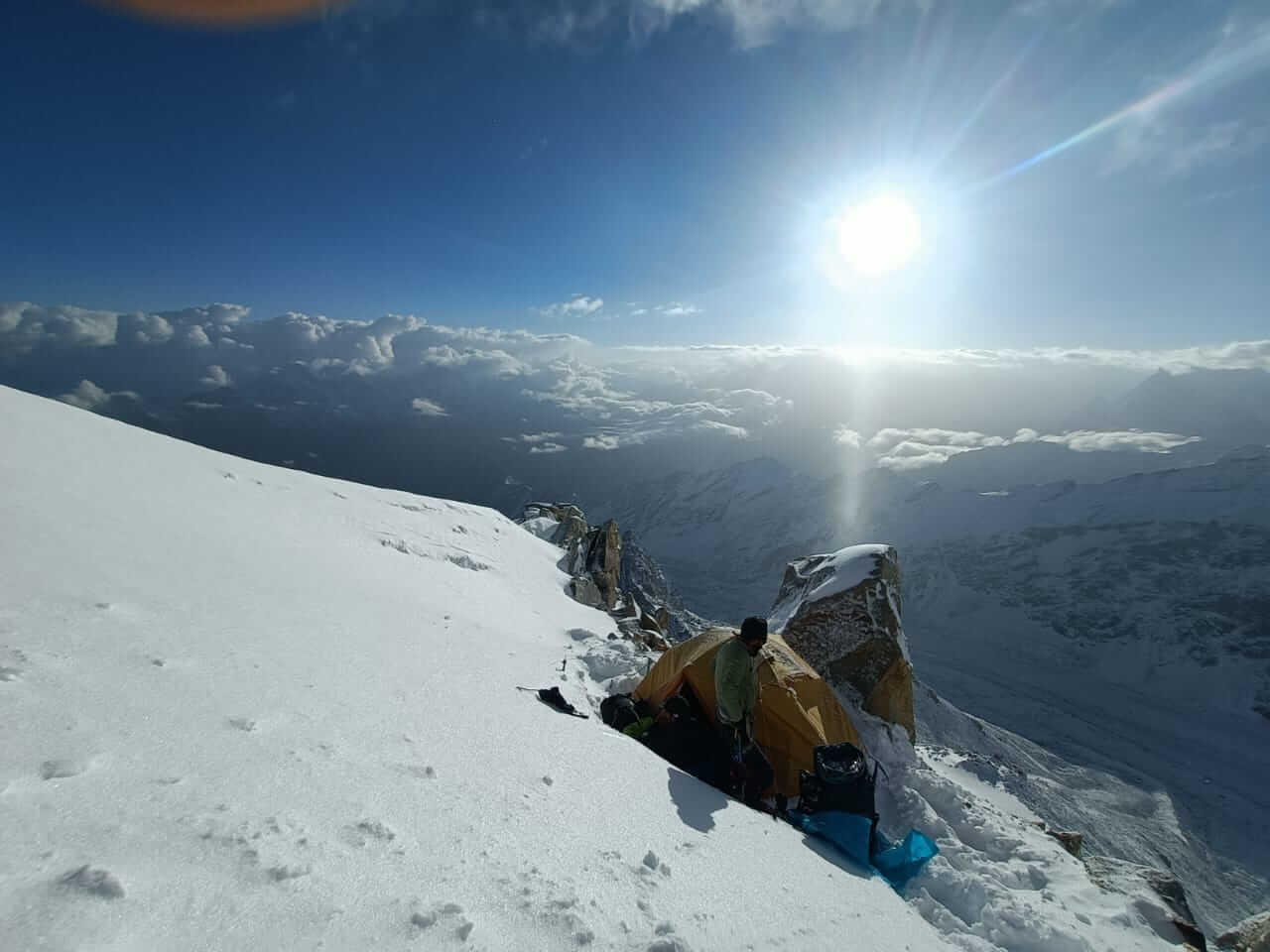
One of the most beautiful mountains on Earth is Mt. Shivling (21,467 FT), which may be found near Tapovan in the Western Garhwal Himalaya. Once upon a time, this snow-capped summit was known as the “Indian Matterhorn” due to its sharp peaks and teeth-like prominence. Tapovan, Shivling’s base camp, is situated at a towering 6543 metres above sea level and offers the greatest views of the mountain. The use of crampons and jumars, as well as the ability to ascend and descend using rope methods, are all prerequisites for reaching the peak. The Bhagirathi River begins from the Gangotri Glacier, which is located close to the foot of the mountain.
The steepness and conical form of this mountain make it a favourite among mountaineers eager to test their mettle and prepare for peaks higher than 7,000 metres. The Gangotri path, which the hike to Mt. Shivling follows, is famous for its breathtaking views of the Indian Himalayas. Tapovan’s base camp, surrounded by jagged peaks, is undeniably one of the world’s most picturesque camping spots. Your dream of climbing Mt. Shivling might come true if you decide to undertake the journey.
Below down is the short itinerary for Mount Shivling Expedition:-
- DAY 1 : Arrive in Gangotri
- DAY 2: Acclimatization in Gangotri
- DAY 3 : Gangotri to Bhojwasa (12,440 FT) via Chirwasa (11,811 FT). 14 km trek
- DAY 4 : Bhojwasa (12,440 FT) to Tapovan/Base Camp (14,642 FT) via Gaumukh (12,770 FT)
- DAY 5 : Acclimatization Day at Tapovan/Base Camp
- DAY 6 : Base Camp to Advanced Base Camp (ABC) and back to Base Camp
- DAY 7 : Base camp to ABC
- DAY 8 : ABC to Camp 1 (17,400 FT) and back to ABC
- DAY 9 : ABC to Camp 1 (17,400 FT)
- DAY 10 : Camp 1 to Camp 2 (19,193 FT) and back to Camp 1
- DAY 11 : Camp 1 to Camp 2 (19,193 FT)
- DAY 12 : Camp 2 to Summit Camp and back to camp 2
- DAY 13 : Camp 2 to Summit Camp
- DAY 14 : Summit Camp to Summit (21,467 FT) and back to Camp 2
- DAY 15 : Camp 2 to Tapovan/Base Camp
- DAY 16 : Rest Day at Base Camp
- DAY 17 : Base Camp to Bhojwasa
- DAY 18 : Bhojwasa to Gangotri
- DAY 19 : Gangotri to Dehradun
- DAY 20 : Reserve Day
For detailed itinerary:- Mount Shivling Expedition
- Mount Satopanth Expedition
Mt. Satopanth is the second-highest peak in Uttarakhand’s Gangotri mountain range. At 7075 metres, this summit, which means “True Route” in the local dialect, is definitely a challenge. The way to the peak is fraught with danger, including a steep glacier ascent, steep snow slopes, and a treacherous knife-edge ridge. Participation in this adventure is restricted to would-be mountaineers who have prior expertise with ice axes, crampons, rope-up methods, and jumar climbing. The aspirant has to be physically strong and have a high degree of mental endurance because of the variable weather and challenging terrain faced during this voyage.
Many Indian mountaineers choose Mt. Satopanth as a warm-up climb before conquering 8000m+ summits, including Mt. Everest. If you’re a climber looking to make the transition from peak-hopping to summit climbing, this trip is it. The months of August and September are great for this journey. All mountaineers who have climbed summits of 6,500 metres or more should aim for Mt. Satopanth as their next challenge.
Below down is the short itinerary for Mount Satopanth Expedition:-
- DAY 1 : Dehradun to Gangotri (10200 ft) – 100 km Drive
- DAY 2 : Acclimatisation in Gangotri
- DAY 3 : Gangotri to Bhojwasa (12500 ft) – 14 km Trek
- DAY 4 : Bhojwasa to Tapovan (14600 ft) – 13 km Trek
- DAY 5 : Tapovan to Nandanvan (14300 ft) – 8 km Trek
- DAY 6 : Nandanvan to Vasuki Tal [Base Camp] (16000 ft) – 6 km Trek
- DAY 7 : Acclimatisation at Base Camp
- DAY 8 : Vasuki Tal to Camp 1 (16830 ft)
- DAY 9 : Acclimatisation at Camp 1
- DAY 10 : Camp 1 to Camp 2 (19000 ft)
- DAY 11 : Acclimatisation at Camp 2
- DAY 12 : Camp 2 to Summit Camp (20340 ft)
- DAY 13 : Acclimatisation at Summit Camp
- DAY 14 : Summit Push (23200 ft)
- DAY 15 : Summit Camp to Camp 1
- DAY 16 : Camp 1 to Vasuki Tal
- DAY 17 : Vasuki Tal to Nandanvan – 6 km Trek
- DAY 18 : Nandanvan to Chirwasa – 26 km Trek
- DAY 19 : Chirwasa to Uttarkashi – 8 km Trek, 100 km Drive
- DAY 20 : Depart from Uttarkashi
For detailed itinerary:- Mount Satopanth Expedition
- Trishul Peak Expedition
Mt. Trishul is one of the most well-known and demanding mountains that can be found in the Uttarakhand area of the Himalayas. It is rated as a mountain peak that is somewhere from moderate to tough. Mt. Trishul-1 is the most well-known of the three peaks that make up the summit, and it is also the one that has seen the most attempts made by mountain climbers. The other two peaks have elevations of 6690 metres and 6007 metres, respectively. The mountain was given its name because of its distinctive form, which resembles Trishul, one of Shiva’s weapons. According to historical records, Trishul-1 was the first summit with an elevation of more than 7,000 metres to ever have an ascent attempt made on it in the year 1907. The ascent of this mountain takes around twenty-six days, and the months of May through June and September through October are ideal for making the effort.
Below down are the short itinerary for Trishul Peak Expedition:-
- DAY 01: ARRIVE DELHI (216 M) FLIGHT
- DAY 02: DELHI – RISHIKESH 372M DRIVE 250 KMS | 6 HRS
- DAY 03: RISHIKESH – KARANPARYAG – GHAT (1450 M) DRIVE 210 KMS | 7 HRS
- DAY 04: GHAT – SITEL (BY DRIVE) – SUTOL (2350 M) DRIVE AND TREK
- DAY 05: SUTOL – LATAKHOPRI (3080 M) TREK
- DAY 06: LATAKHOPRI – BASE CAMP (4350 M) TREK
- DAY 07-21: BASE CAMP – SUMMIT – BASE CAMP CLIMBING PERIOD
- DAY 08: ACCLIMATISATION DAY
- DAY 09: ADVANCE CAMP (4660 M)
- DAY 10: ADVANCE CAMP TO CAMP 1 (5160 M)
- DAY 11 & 12: ACCLIMATISATION DAYS AND LOAD FERRY
- DAY 13- 14: CAMP 1 TO CAMP 2 (5850 M)
- DAY 15 & 16: LOAD FERRY
- DAY 17-18: CAMP 2 TO SUMMIT CAMP (6340 M)
- DAY 17: SUMMIT CAMP – SUMMIT (7120 M) – CAMP 2
- DAY 18 & 19: RESERVE DAY FOR SUMMIT
- DAY 20-21: CAMP 2 – BASE CAMP
- DAY 22: BASE CAMP – SUTOL TREK
- DAY 23: SUTOL – SITEL – GHAT TREK AND DRIVE
- DAY 24: GHAT – RISHIKESH DRIVE 210 KMS | 6 HRS
- DAY 25: RISHIESH – DELHI DRIVE 250 KMS | 6 HRS
- DAY 26: DELHI DEPART
- Mount Bandarpunch Expedition
Bandarpunch (Bandarpoonch), which translates to “Monkey’s Tail” or “Hanuman’s Tail” in Hindi, is a stunning massif located in Uttarakhand’s Western Garhwal Himalayas. The name Bandarpunch comes from the word “Bandar,” which means “tail.” The massif is comprised of the three peaks of Bandarpunch I (6316 M), Bandarpunch 2 (6102 M), and Kalanag (Black Peak – 6387 M). The ascent of Bandarpunch 1 is recommended for climbers who have experience scaling peaks that are at least 7,000 metres in altitude. In order to avoid appearing overly academic, the ascent of Bandarpoonch peak should only be attempted by individuals who have previous experience with trekking and a comprehensive understanding of mountaineering techniques, as well as the use of technical equipment such as rope-up procedures, jumars, and crampons.
The road to the top is riddled with crevasses, and the weather on the mountain can never be predicted accurately. This presents a number of challenges for the expedition. It is essential to acclimatise to the high elevations that are found on the mountain. A breathtaking panorama of the surrounding mountains can be seen from the summit, including the peaks of Kalanag, Swargarohini, Satopanth, Sudarshan Parvat, Jogin, and the Gangotri range. The Bandarpunch Glacier, which is the origin of the Yamuna River, may be reached by following the trail. The most used path to the top of the mountain is located in the south-eastern part, and we will choose that one. The ascent of Bandarpoonch Peak, one of the most breathtaking summits in the Garhwal Himalayas, is a challenge for mountaineers who want to see how far they can push themselves.
Below down are the short itinerary for Mount Bandarpunch Expedition:-
- DAY 1 : Delhi to Dehradun
- DAY 2 : Drive from Dehradun to Uttarkashi
- DAY 3 : Uttarkashi to Sukhi to Forest Camp
- DAY 4 : Trek to Forest camp towards base camp
- DAY 5 : Base camp – Prep Day
- DAY 6 : Trek from Base Camp to Camp I then return to Base Camp
- DAY 7 : At Base Camp – Rest Day
- DAY 8 : Base Camp to Camp I
- DAY 9 : Camp I – Acclimatization Day
- DAY 10 : Acclimatization at Camp I
- DAY 11 : Camp I to Summit Camp
- DAY 12 : Rest Day
- DAY 13 : Summit Camp to Summit and back to Summit Camp
- DAY 14 : Contingency day
- DAY 15 : Summit to Base Camp
- DAY 16 : Base Camp to Forest Camp
- DAY 17 : Forest Camp to Sukhi and then to Uttarkashi
- DAY 18 : Uttarkashi to Dehradun to Delhi
For detailed itinerary: Mount Bandarpunch Expedition
- Mount Nanda Ghunti Expedition
There is a peak in the Nanda Devi National Park in the Garhwal Himalayas called Mt. Nanda Ghunti (6,309 metres), which is also known as the “Veil of Goddess Nanda Devi“. From the famous Roopkund walk, one may get a good view of this enormous peak as well as the gigantic Trishul massif, which is formed like a trident. The ascent of Mt. Nanda Ghunti has attracted a large number of climbers who are looking for a difficult route. The mountain is notorious for having erratic weather and crevasses all the way up to the top, despite the fact that it is not very difficult from a technical standpoint. From the highest point, one has a view of a multitude of mountains, including Mt. Trishul, the Chaukhamba range, Kamet, Nanda Devi, and Dronagiri.
Below down are the short itinerary for Mount Nanda Ghunti Expedition:-
- DAY 1 : From Dehradun to Guttu
- DAY 2 : From Guttu to Reeh
- DAY 3 : From Reeh to Gangi
- DAY 4 : From Gangi to Kharsoli
- DAY 5 : From Kharsoli to Chowki
- DAY 6 : From Rest and Acclimatization
- DAY 7 : From Chowki to Masar Tal
- DAY 8 : From Masar Tal to Vasuki Tal via Mayali Pass
- DAY 9 : From Vasuki Tal to Kedarnath
- DAY 10 : From Kedarnath to Gaurikund
- DAY 11 : Depart from Gaurikund towards Dehradun
For detailed itinerary: Mount Nanda Ghunti Expedition
- Mount Swargarohini Peak Trek Expedition
Swargarohini Trek is a four-peak mountain range in Uttarakhand’s Garhwal Himalayas. The title of this trek is “Way to Heaven.” At an elevation of -17,987 feet, the Chamoli district in Uttarakhand may be found. According to one version of the mythology, the Pandavas travelled to heaven along this route. Yudhishthira, one of the Pandavas, and a dog were the only ones that crossed across into the afterlife. On their journey, several of the other Pandavas were killed. Mythology suggests that Swargarohini is the one and only means of ascending to Heaven while retaining one’s human form. The Chaukhamba massifs are home to Satopanth Lake, which is considered to be the holiest lake in the region. It is said that Lord Brahma, Lord Vishnu, and Lord Mahesh all had baths in the waters of this lake, which is why it is considered to have holy and delicious waters.
Below down are the short itinerary for Mount Swargarohini Peak Trek Expedition:-
- DAY 1 : From Haridwar to Joshimath
- DAY 2 : From Joshimath to Badrinath
- DAY 3 : Badrinath to Laxmivan
- DAY 4 : From Laxmivan to Chakratirth
- DAY 5 : Chakratirth towards Satopanth Tal Trek
- DAY 6 : Satopanth Tal to Chandrakund trekking
- DAY 7 : Chandrakund to Suryakund trek
- DAY 8 : Rest and Acclimatization Day
- DAY 9 : Suryakund to Swargarohini base camp Trekking
- DAY 10 : Suryakund towards Satopanth Tal Trek
- DAY 11 : Satopanth Tal to Laxmivan Trek
- DAY 12 : Laxmivan to Badrinath 4/5 Hours journey
- DAY 13 : Badrinath to Haridwar
For a detailed itinerary: Mount Swargarohini Peak Trek Expedition
- Bhagirathi II Expedition
There are three main summits on the Bhagirathi Parbat. Bhagirathi I stands at a lofty 6856 metres, whereas Bhagirathi II is located at a more manageable 6512 metres, and Bhagirathi III is at 6454 metres. The tallest Bhagirathi peaks make up a complex massif in terms of their topography. It towers above the surrounding landscape and serves as a landmark for travellers heading to the Gaumukh, where the Gangotri Glacier ends and the Ganges begins its journey downstream.
Mount Bhagirathi II is one of the world’s highest mountains at 6,512 metres and is revered by many Hindus because of its size and location. The mountain’s peak is dotted with religious buildings, drawing people from all around to pay their respects. The Hindu faithful hold the Gaumukh glacier, one of the Ganges’ most significant originating points, in the highest regard. In addition to the holy Gangotri springs, the Gangotri glacier is a major contributor to the river’s water supply. Mount Bhagirathi II attracts many pilgrims who come to pay their respects at the mountain’s many temples and shrines. There are many hikers and mountaineers that visit the peak each year.
Mount Bhagirathi II is your ultimate destination if you’ve been craving excitement. This peak in Uttarakhand is an excellent destination for hikers and explorers. Amazing scenery awaits you at the peak, and the journey itself will be an unforgettable experience. The breathtaking views, the strenuous trek, and the rewarding feeling of achievement at the peak are all highlights of the trip. Mount Bhagirathi II is an incredible trek for everyone, whether you’re an experienced mountaineer or just starting out. Exactly how long are you going to wait? It’s time to get busy organising your vacation!
Mount Bhagirathi II in Uttarakhand, India, is a fantastic hiking destination if you’re seeking for a thrilling ascent. It’s an unforgettable experience that’s topped off with breathtaking panoramas. The Mount Bhagirathi II Expedition is ideal for those who thrive on difficulty. The challenging climb is well worth it since it passes through some of the world’s most stunning landscapes. So, why do you linger? Get the ball rolling on your journey now!
Below down are the short itinerary for Mount Bhagirathi II Expedition:-
- DAY 01: ARRIVE DELHI
- DAY 02: DELHI – RISHIKESH DRIVE 250 KMS / 6- 7 HRS
- DAY 03: RISHIKESH – UTTARKASHI DRIVE 170 KMS / 6- 7 HRS
- DAY 04: UTTARKASHI – GANGOTRI (3048M) DRIVE 95 KMS / 4 HRS
- DAY 05: GANGOTRI – BHOJBASA (3792 M) TREK 14 KM
- DAY 06: BHOJBASA – GAUMUKH (3892M) – NANDANVAN/BASE CAMP (4340M)
- DAY 07-18: BASE CAMP – SUMMIT MT. BHAGIRATHI II – BASE CAMP
- DAY 19: BASE CAMP – BHOJBASA (4460 M) TREK: 10 KM
- DAY 20: BHOJBASA – GANGOTRI – UTTARKASHI TREK: 14 KM/DRIVE 95 KMS
- DAY 21: UTTARKASHI – RISHIKESH DRIVE 170 KM
- DAY 22: RISHIKESH – DELHI DRIVE 250 KM
- DAY 23: DELHI DEPART
- Auden’s Col Expedition:-
One of the challenging Garhwal Himalayan treks in Uttarakhand is Auden’s Col. This region of the Himalayas is not very well visited. A high mountain pass known as Auden’s Col is at an elevation of 5490 metres and connects the summits of Jogin I (6465 metres) and Gangotri III (6580 metres). John Bicknell Auden, a British Geographical Survey Officer, made the discovery of Auden’s Col in the year 1935. In addition, the Khatling and Jogin I glaciers, which are located on opposing sides of the pass, are connected by this mountain pass. This journey will take you to two of India’s most important religious destinations: Gangotri and Kedarnath. Kedarnath is not only a well-known religious destination, but it is also one of India’s twelve Jyotirlingas.
Because it traverses moraines, narrow cliffs, rocks, unending glaciers, and challenging ridges, the Auden’s Col hike is best suited for experienced hikers who have a high level of both physical fitness and mental fortitude. This trip is a once-in-a-lifetime opportunity since the walk offers breathtaking vistas of peaks such as Rudragaira, Gangotri group, Jogin group, Bhagirathi group of peaks, and Kedar Dome.
Below down are the short itinerary for Auden’s Col Expedition:-
- Day 1 : 270 km drive from Dehradun to Gangotri (10100 ft)
- Day 2 : Rest and acclimatization at Gangotri (10100 ft)
- Day 3 : Gangotri to Nala Camp (12335 ft) – 7 km
- Day 4 : 4 km from Nala Camp to Rudugaira Camp (14800 ft).
- Day 5 : Rest at Rudugaira Base Camp & acclimatize your body (14800 ft)
- Day 6 : 7 km from Rudugaira Base Camp to Auden’s Col Base Camp (16000 feet) via Gangotri Base Camp
- Day 7 : 5 kilometers from Auden’s Col Base Camp to Khatling Glacier Camp (16800 ft) via Auden’s Col (18000 ft)
- Day 8: 10 km from Khatling Glacier Camp to Zero Point (12700 ft)
- Day 9 : Day of RestDay 10: 7 km from Waterfall Camp/Zero Point to Chowki (11750 ft)
- Day 10 : 7 km from Waterfall Camp/Zero Point to Chowki (11750 ft)
- Day 11 : 8 km from Chowki to Masar Tal (14960 ft)
- Day 12 : Masar Tal (14435 ft) to Vasuki Tal (14435 ft) – 12 km via Mayali Pass (16900 ft)
- Day 13 : Vasuki Tal to Kedarnath (11800 ft) is a 7-kilometer trek.
- Day 14 : 14 km from Kedarnath to Gaurikund (6530 ft)
- Day 15 : The drive from Gaurikund to Dehradun is 252 kilometres.
For detailed Itinerary: Auden’s Col Expedition
- Mount Meru Peak Expedition
Meru Parvat, which is said to be the centre of the universe in our ancient scriptures, has been one such obsession for mountaineers for decades. It doesn’t leave their thoughts and dreams, and it haunts them to return. Conrad Anker, one of the most well-known mountaineers in the world, had been obsessed with it for years and had attempted to climb it thrice before finally succeeding in 2012. Jimmy Chin and Renan Ozturk also succeeded in climbing it in 2012.
Below down are the short itinerary for Mount Meru Peak Expedition:-
- DAY 1 : DRIVE TO GANGOTRI (3,100 M/10,200 FT): 250 KM/10-12 HOUR DRIVE
- DAY 2 : TREK FROM GANGOTRI TO CHIRBASA (3,585 M/11,761 FT): 9 KM/6 HOURS TREK
- DAY 3 : TREK FROM CHIRBASA TO BHOJBASA (3,795 M/12,450 FT): 5 KM/3 HOURS TREK. ACCLIMATISATION WALK TO GAUMUKH.
- DAY 4 : TREK FROM BHOJBASA TO TAPOVAN (4,463 M/14,640 FT): 10 KM/7 HOURS TREK
- DAY 5 : EXPLORE TAPOVAN
- DAY 6 : TAPOVAN TO CHIRBASA
- DAY 8 : UTTARKASHI TO DEHRADUN